

🥾 Easy hikes without a car: trails near the capitals of Scandinavia
Scandinavian capitals are perfect for a “city + one-day trail” format: in the morning you leave your hotel, take the metro or a train, and 30–60 minutes later you’re already walking through a forest, along a lake or by the sea. 🌲
You don’t need a car, a driving licence, rental experience or heavy trekking gear — just basic equipment and a realistic choice of route.
This guide is for “urban active” travellers: you enjoy museums and cafés, but want at least one day on the trail without turning the whole trip into a trekking tour.
Below you’ll find ready-to-use routes around Copenhagen, Oslo, Stockholm and Helsinki — with logistics, approximate timing and clear difficulty levels.
🧭 How to choose an easy trail without a car
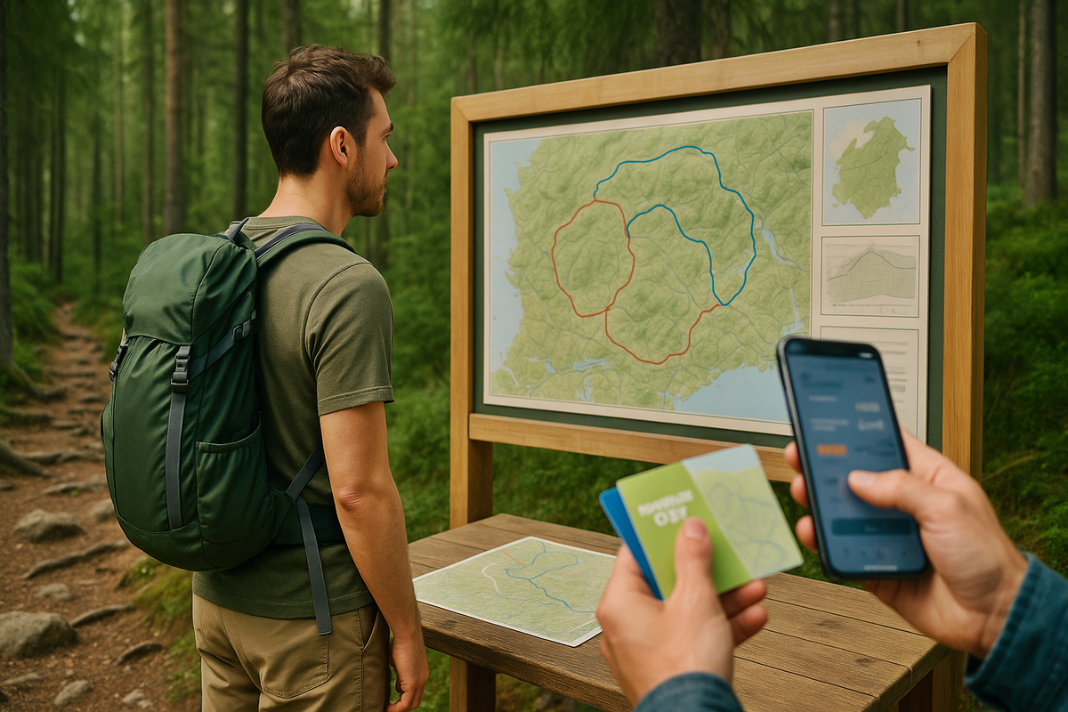
Before picking a specific route, it’s important to understand the framework: what counts as an “easy hike” for a city traveller without a car.
🔍 Key criteria for choosing a route
- 📏 Route length. For a first experience, a comfortable range is 5–12 km, including photo stops, short breaks and a margin for daylight.
- ⛰️ Elevation gain. Even 7–8 km in the forest with a 300–400 m climb can feel harder than 15 km on flat city pavement. For beginners, a good guideline is up to 200–250 m elevation gain.
- 🥾 Surface type: well-trodden forest roads; trails with roots and stones; boardwalks in wet or boggy areas; sometimes rocky sections along the coast.
- 🧩 Waymarking and navigation: coloured marks on trees and rocks; signposts at junctions; trail maps and boards at park entrances.
🌧️ What seriously affects difficulty
Even an “easy” trail can turn into a challenge if:
- it has rained recently → mud, puddles, slippery roots and rocks;
- there’s strong wind on open coastal sections;
- in late autumn and winter the daylight is short — it’s easy to end up walking in the dark;
- in winter or during thaws there may be ice on the paths — you need good tread or even microspikes.
🗺️ What to check in the description and on the map
- Elevation profile: whether there is one long, steep climb.
- Type of landscape: forest, bogs, rocks, coastline.
- Start/finish: how the trail connects to transport stops, whether there is a short loop option.
🌳 Copenhagen: forest, deer and sea within S-train reach
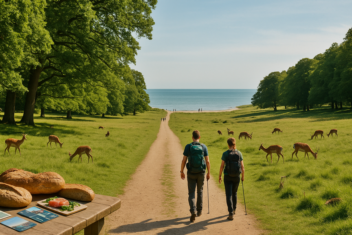
Copenhagen is one of the easiest cities for a “soft” intro to hiking: most light routes are in the S-train or metro zone and elevation is minimal.
🌿 Dyrehaven and the coast near Klampenborg
How to get there: From central Copenhagen take an S-train to Klampenborg station (~20–25 minutes). Trains run frequently throughout the day.
Route parameters: distance: 8–12 km (can be shortened to 5–6 km); elevation gain: minimal; time: 2.5–4 hours at an easy pace.
What to expect:
- a large deer park with meadows and forest roads;
- access to the Øresund coast, with the option to walk to Bellevue beach;
- surfaces are mainly gravel and dirt roads, some asphalt.
Infrastructure: Cafés and toilets near the station and at the beach, plenty of benches and picnic spots.
Who it’s for: An ideal first route in Denmark: almost flat, easy to navigate, beautiful in any season.
🌾 Amager Fælled and Amager Strand
How to get there: Metro to Islands Brygge, DR Byen or Sundby (5–10 minutes from the city centre).
Route parameters: distance: 7–10 km; elevation gain: almost none; time: 2–3.5 hours.
Features:
- semi-wild green area with meadows, ponds and small paths;
- you can extend the walk out to Amager Strand beach;
- expect strong wind on open sections in the colder months.
Infrastructure: Cafés closer to the metro and waterfront; in the central green area it feels more “natural”.
🌲 Hareskoven: classic Danish forest
How to get there: S-train to Hareskov station (~20–25 minutes from the centre).
Route parameters: distance: 7–11 km (several loop options); elevation gain: up to 150 m; time: 3–4 hours.
Surface:
- forest paths with roots, sand and occasional mud;
- trail maps at car parks and the station.
Seasonality: Wet in spring and autumn, possible ice in winter; in summer it’s a pleasantly cool forest walk.
🌲 Oslo: Oslomarka as the city’s “backyard”

Oslo is a paradise for forest lovers: locals just hop on the metro, ride 20–30 minutes, get off and immediately enter the woods. As a visitor you can do the same.
🦌 Classic route: Sognsvann – Ullevålseter
How to get there: Metro (T-bane) to Sognsvann (~15–20 minutes from the centre); the lake is right by the station.
Route parameters: distance: 8–10 km; elevation gain: ~200–250 m; time: 3–4 hours.
Along the way:
- from Sognsvann lake on well-maintained forest roads up to the mountain hut Ullevålseter;
- forest, gentle climbs, groomed ski tracks in winter;
- in summer and autumn it’s an easy forest hike, in winter it becomes a proper winter outing (you need warm layers).
Infrastructure: Ullevålseter has a café with simple hot dishes and pastries, plus toilets; there are picnic spots around the lake.
🏞️ Frognerseteren with views of the fjord
How to get there: Metro to terminal station Frognerseteren (~30 minutes from the centre).
Route parameters: distance: 5–8 km (several loops); elevation gain: 150–250 m; time: 2.5–4 hours.
Features:
- trails with roots and stones, some steeper sections;
- good signposting, but in bad weather an offline map is helpful;
- in clear conditions you get excellent views over the Oslofjord.
Infrastructure: Café/restaurant at the station, toilets and several rest spots.
🌲 Østmarka from Skullerud: a slightly “wilder” forest
How to get there: Metro to Skullerud (~20–25 minutes), from the station there’s an entrance into Østmarka.
Route parameters: distance: 7–10 km; elevation gain: 200–300 m; time: 3–4 hours.
Features:
- more natural, “wild” forest: roots, stones, boardwalks and boggy sections;
- good trails, but you need to pay more attention to the waymarks;
- feels like a real forest hike rather than an urban park.
🏝️ Stockholm: forests and sea trails in one package

Stockholm combines green reserves and archipelago routes; some are within the city, others are 40–60 minutes away by public transport.
🌲 Tyresta National Park
How to get there: Metro to Gullmarsplan, then a bus to Tyresta by. Total travel time 45–60 minutes.
Route parameters: distance: 7–10 km; elevation gain: up to 200 m; time: 3–5 hours.
Along the route:
- pine forests, rocky outcrops by lakes, boardwalks in wet areas;
- several marked loop trails;
- maps and an information centre at the main entrance.
🧘 Hellasgården and Nacka Nature Reserve
How to get there: Bus from Slussen/Gullmarsplan, around 15–25 minutes to stops near Hellasgården.
Route parameters: distance: 5–8 km; elevation gain: up to 150 m; time: 2–3 hours.
Features:
- forest trails and rocks along the water;
- many sections become slippery after rain;
- a popular spot for locals, can be busy on weekends.
Infrastructure: Sauna, café, toilets — a great option if you want to combine a hike with a “Scandinavian evening”.
🌳 Djurgården: semi-urban “hike” on an island
How to get there: On foot, by tram or by ferry from the centre (5–15 minutes).
Route parameters: distance: 7–9 km in a loop; elevation gain: minimal; time: 2–3 hours.
Format:
- park paths, waterfront walks and small wooded sections;
- easy to shorten or extend, with many exit points back to the city;
- perfect if you want “light nature” with zero risk of getting lost.
🌲 Helsinki: national parks for a day trip
Finnish parks around Helsinki are designed for exactly this format: arrive by bus, hike a loop, return to the city.
🦉 Nuuksio (Haukkalampi area)
How to get there: Train to Espoo or Leppävaara, then a bus to stops near Haukkalampi. Travel time 45–60 minutes.
Route parameters: distance: 5–8 km; elevation gain: 150–200 m; time: 2.5–4 hours.
Features:
- classic Finnish forest: rocks, roots, lakes, boardwalks;
- several colour-coded loops of different lengths;
- popular with locals, but you can still find quiet corners.
🌲 Sipoonkorpi
How to get there: Buses from Helsinki to park entrances (e.g. Byabäcken), around 40–60 minutes.
Route parameters: distance: 5–9 km; elevation gain: up to 200 m; time: 2.5–4 hours.
Features:
- a wetter, wilder character with many muddy sections after rain;
- good but sometimes narrow trails;
- strong “deep forest” feeling surprisingly close to the capital.
🌳 Keskuspuisto — Helsinki Central Park
How to get there: Metro/train to districts next to the park (e.g. Pasila), 5–10 minutes from the centre.
Route parameters: distance: 8–10 km; elevation gain: minimal; time: 2.5–4 hours.
Features:
- forest roads, some asphalt, small trails along streams;
- easy to cut the route short and return to the city at any point;
- feels like something between “in the city” and “in the forest”.
📊 Summary table of trails near the capitals
Below is a compact overview so you can quickly compare distances, timing and seasonality.
| 🥾 Trail | 🏙️ Capital | 📏 Distance | ⛰️ Elevation gain | ⏱️ Time | ⭐ Difficulty | 🍂 Seasonality |
|---|---|---|---|---|---|---|
| 🌿 Dyrehaven loop | Copenhagen | 8–12 km | minimal | 2.5–4 h | very easy | year-round |
| 🌾 Amager Fælled | Copenhagen | 7–10 km | none | 2–3.5 h | very easy | year-round, windy |
| 🌲 Hareskoven loop | Copenhagen | 7–11 km | up to 150 m | 3–4 h | easy | late spring–autumn |
| 🦌 Sognsvann–Ullevålseter | Oslo | 8–10 km | ~200–250 m | 3–4 h | easy/medium | summer–autumn, winter with spikes |
| 🏞️ Frognerseteren loops | Oslo | 5–8 km | 150–250 m | 2.5–4 h | easy/medium | summer–autumn, careful in winter |
| 🌲 Østmarka from Skullerud | Oslo | 7–10 km | 200–300 m | 3–4 h | medium | best in dry season |
| 🌲 Tyresta loop | Stockholm | 7–10 km | up to 200 m | 3–5 h | easy/medium | all seasons except heavy thaw |
| 🧘 Hellasgården loops | Stockholm | 5–8 km | up to 150 m | 2–3 h | easy | year-round |
| 🌳 Djurgården loop | Stockholm | 7–9 km | minimal | 2–3 h | very easy | year-round |
| 🦉 Nuuksio (Haukkalampi) | Helsinki | 5–8 km | 150–200 m | 2.5–4 h | easy/medium | late spring–autumn |
| 🌲 Sipoonkorpi loops | Helsinki | 5–9 km | up to 200 m | 2.5–4 h | medium | best in dry season |
| 🌳 Keskuspuisto | Helsinki | 8–10 km | minimal | 2.5–4 h | very easy | year-round |
🧮 Mini time calculator for your hike
Here’s a simple calculator you can embed so readers can estimate their time on the trail:
🧮 Estimate your hiking time
Enter the trail length and your average walking speed.
✅ Practice and checklist for an easy hike without a car
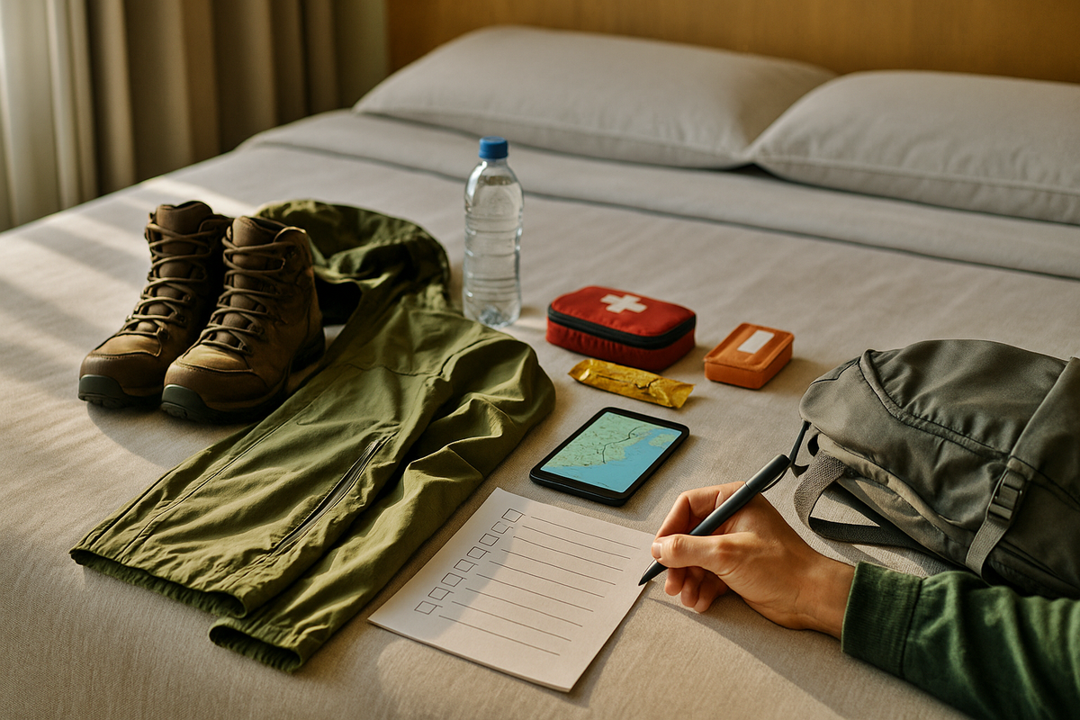
What you must take with you:
- comfortable closed shoes with a grippy sole;
- a windproof/rain jacket and an extra warm layer;
- 0.7–1 litre of water and a simple snack;
- a phone with offline maps and a power bank;
- a small first-aid kit and plasters.
How to plan your day:
- start as early as possible, especially in autumn and winter;
- check the forecast for rain, wind and sunset time;
- look up the return schedule in advance and save the stop on your map;
- have a plan B — a shorter loop or simpler nearby route.
Typical beginner mistakes:
- leaving late and entering the forest in the second half of the day;
- picking a route that’s too long “by eye”;
- wearing shoes with poor grip → slipping on roots and rocks;
- not bringing enough water and no extra layer.
🙋♀️ FAQ
💬 In dry summer on simple trails, sturdy trainers with good tread are usually enough, but in shoulder seasons hiking boots are much more comfortable and safer.
💬 On average 3–4.5 hours with breaks, plus travel time to and from the trail.
💬 On popular marked trails near the capitals you’ll be walking alongside locals, and with offline maps and attention to signs the risk is very low.
💬 Yes, if the route is up to 5–8 km and travel to the trail is no more than 30–40 minutes, provided you start early.
💬 It’s easiest to start with Copenhagen and Stockholm (Amager Fælled, Djurgården) and then move on to more “forest-heavy” scenarios around Oslo and Helsinki.

0 comments
Log in to leave a comment